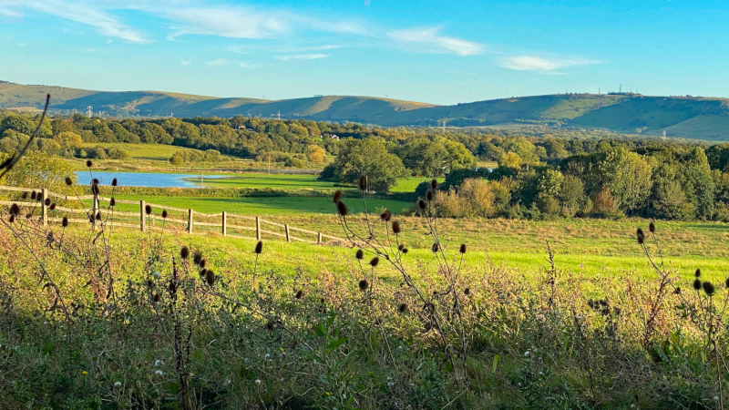
TRAIL LOCATION - Crossing the brooks, Rye Farm
The view from here and other parts of the path looks out over fields which, in summer, is used to graze livestock. In winter the fields often flood, and the regularity of this has led to the fields on either side of the river - the water meadows - being known locally as the "brooks". The brooks support a huge variety of bird species.
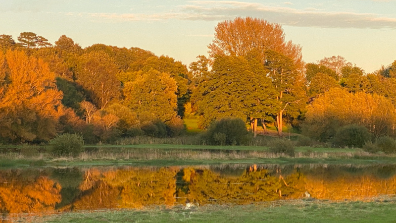
Rye Farm
The river Adur and its floodplains have played a prominent part in the development of Henfield. Henry de Candole (1947) envisages Saxon boats sailing all the way up and settling the high ground at Henfield. He believes that the Adur was first embanked under Henry VIII. It was then made navigable for large barges in the early 19th Century.
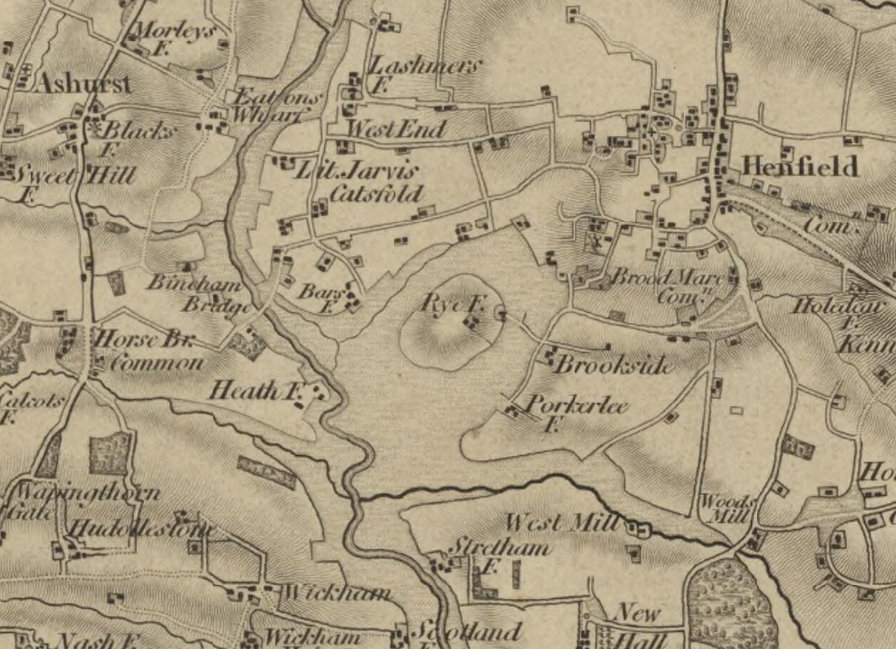
Rye Farm was a central point on a traditional point on a traditional cattle droveway, as the 1813 OS map (left) shows. De Candole states that the route started at the west end of Dagbrook Lane, crossed the brooks to Rye Farm, circled half the island and turned up to meet the track below Frogshole and Harwoods. In dry weather the route is still traceable today.
The original farmhouse, a 14th century timber-framed building and Grade II listed, is a prominent landmark visible across a wide area.
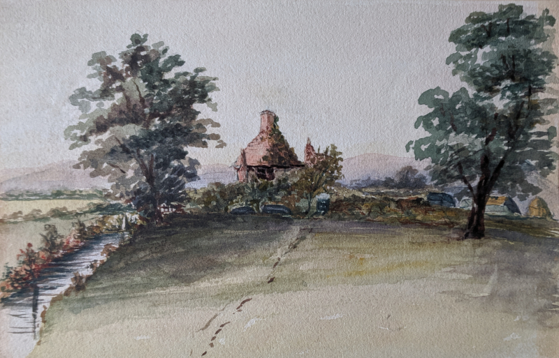
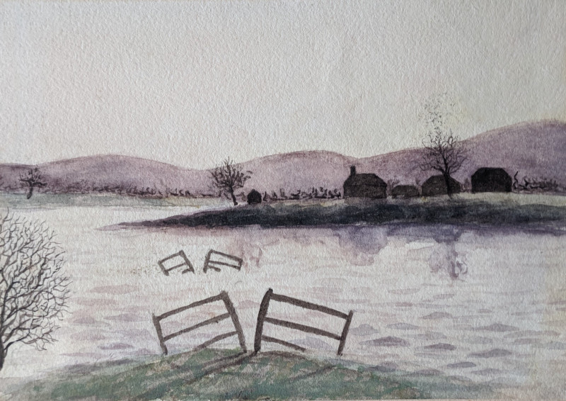
The old house, shown in a watercolour by Daisy Wade (left), remains in use as a private residence and is now protected against flooding by a bund. Please repsect the privacy of the occupants.
The heritage importance of Rye Farm, however, goes beyond the building itself. The setting is entirely unique along the whole of the Adur valley. It is the only farmhouse with an Out Farm set in the middle of flood meadows, as opposed to those on higher ground that have land running down to the flood meadows.
Flooding around ‘Rye Island’, watercolour painting by Armigel Wade c. 1900
Postcard of Rye island in the floods, c. 1900 looking SW from Windmill Hill. Wade Collection
%2C%20by%20Merrett%2C%20(posted%20to%20Miss%20Wade%2C%201908)%2C%20Henfield%20Museum%20Collectionx800.jpg)
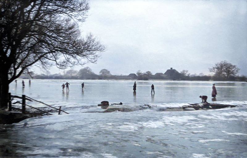
Skating on the frozen floods, c.1900, with Rye Farmhouse in the background. Wade Collection
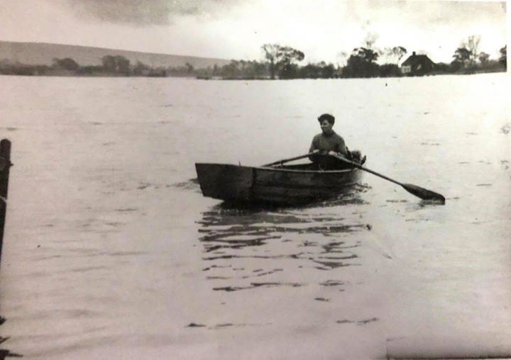
Rowing across the floods to Rye Farmhouse, c. 1950
This location IS on the following trail:
Hidden Henfield aims to bring you some of the highlights from a trip to Henfield. You’ll find suggestions for fantastic walks, alongside historical facts about the sites you can see, as well as information on how to explore the countryside, places to eat and where to stay.
Whether you plan to pop by for a few hours or stay for the weekend, you’ll find inspiration in this unique location.
Hidden Henfield
c/o Henfield Community Partnership
Henfield Parish Office
Coopers Way
Henfield
West Sussex
BN5 9DB

This Website, Green Wayfarer posts in and around Henfield and Visitor Information screen located in Village Care Henfield High Street have been funded by Central Sussex LEADER Local Action Group.
Quick links